COSIT 2024 - Program
Click on a session header to expand or collapse details. The schedule in calendar layout is here.
Please email cosit2024@gmail.com with any questions pertaining to the schedule. A fully expanded, printable version of the program is here. Presentation times are as follows: Full papers (15 minutes), Short papers or Journal/Books (8 minutes).
Full Paper Short Paper Published article or book
Tuesday, September 17
Impact of technology on spatial memory, the hippocampus and implications for healthy cognition

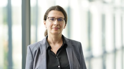
Véronique Bohbot
Professor, McGill University & VeboSolutionsAbstract
Different memory systems, dependent on separate parts of the brain, can sustain successful navigation. The hippocampus is implicated in spatial memory strategies used when finding one’s way in the environment, i.e. it is allocentric and involves remembering the relationship between landmarks. On the other hand, another strategy dependent on the caudate nucleus can also be used, i.e. the response strategy, which relies on making a series of stimulus-response associations (e.g. right and left turns from given positions that act as stimuli, such as turn right at the white building). Adults who use spatial memory strategies showed increased fMRI activity in the hippocampus, increased grey matter in the hippocampus, and better overall cognition compared to adults who use response strategies. Decades of research in my laboratory has shown that specific navigation strategies are associated with several genes, such as BDNF and ApoE, as well as hormones, such as cortisol and progesterone. Experiences dependent modulators such as age, habit, stress and rewards also modulate strategies dependent on the hippocampus and caudate nucleus. Moreover, certain technologies such as Global Position Systems (GPS) or video games inhibit the use of the hippocampus and are associated to poor spatial memory. These results have important implications on mental health because a larger hippocampus has been associated with healthy cognition in normal aging and with a reduced risk of numerous neurological and psychiatric disorders such as Alzheimer’s disease, Schizophrenia, Post-Traumatic Stress disorder and Depression.
Biography
Dr. Véronique Bohbot received her PhD in cognitive neuroscience in 1997 at the University of Arizona under the supervision of Dr. Lynn Nadel, co-author of Nobel Laureate Dr. John O’Keefe. Dr. Bohbot is an internationally recognized expert in the field of spatial memory and navigation. She made over 150 scientific presentations on memory at national and international conferences and published over 80 scientific articles and one book. Her research has been featured in university textbooks, on television, radio and in more than 50,000 internet sites that report the potential effects of technology on the brain. She studied spatial memory in healthy individuals from 8 years old to 85 years of age. She also examined spatial memory in relation to various neurological and psychiatric disorders, such as mild cognitive impairment, Parkinson's disease, diabetes, attention deficit hyperactivity disorder and schizophrenia. Dr. Bohbot’s research uses methods with cutting edge technology such as virtual reality and neuroimaging in order to stimulate memory and the hippocampus, thereby reducing risks of neurological and psychiatric disorders. Currently, Dr. Bohbot holds a Full Professor position in the Department of Psychiatry at McGill University.
(Steven van den Broek, Wouter Meulemans, Andreas Reimer, Bettina Speckmann)
(Zhangyu Wang, Krzysztof Janowicz, Gengchen Mai, Ivan Majic)
(Torsten Hahmann, David K. Kedrowski)
(Keiran Suchak, Ed Manley)
(Subhankar Ghosh, Arun Sharma)
Note that restaurants to the East are downhill from the conference venue (so it may take a bit longer to walk back up).
A few suggestions:
• Aux Anciens Canadiens is a historic restaurant serving classic Quebec cuisine.
• Le Casse-Crêpe Breton is an excellent French Crepery
• Paillard is a great 'boulangerie' for a fast meal
(Erum Haris, Anthony Cohn, John Stell)
(Crystal H. Y. Chen, Lyn Tieu, Ana T. Perez-Leroux)
(Zahur Ashrafuzzaman)
( Majid Hojati, Rob Feick )
(Hu, Yingjie, Gengchen Mai, Chris Cundy, Kristy Choi, Ni Lao, Wei Liu, Gaurish Lakhanpal, Ryan Zhenqi Zhou, and Kenneth Joseph)
( Anthony Cohn, Robert E Blackwell )
Description: Over the last decade, knowledge graphs have become more widespread to share and link all kinds of knowledge on the web. Many of them either focus on or at least include knowledge that is geospatial in nature. The applications are broad: they are used to publicly share information, semantically link information thematically and spatially, and to support advanced inferences and analyses. The development of these geospatial knowledge graphs also raises new research questions, such as how to leverage the spatial and temporal structure to scale these graphs, how to support more advanced semantic inferencing as well as machine learning over geospatial graphs, or how to provide spatio-temporal graph summaries, to name just a few of them.
This session will feature lead researchers involved in the design of a range of geospatial knowledge graphs that are being developed with funding from the National Science Foundational and US federal agencies, including from KnowWhereGraph (Janowicz, Stephen, Cogan Shimizu), The Urban Flooding Open Knowledge Network (UF-OKN: Hahmann), the Safe Agricultural Products and Water Graph (SAWGraph: Hahmann, Stephen), and USGS’s geoconnex (presenter to be confirmed) to present their unique perspectives on the spatial and temporal semantics and structure of these novel large geospatial knowledge graphs. Each will demo examples of geospatial queries and analyses these graphs support and what role semantics play in them. This is followed by a panel discussion exploring the state-of-the-art and the needs of current and potential users, applications and standards. Its primary aim is to identify the research challenges and priorities for the next generation of geospatial semantics and knowledge graphs.
Organizers:
Torsten Hahmann, University of Maine, USA
Krzysztof Janowicz, University of Vienna, Austria
Shirly Stephen, University of California, Santa Barbara, USA
Cogan Shimizu, Wright State University, USA
( Mona Bartling, Zhengfang Xu, Sara Fabrikant )
(Csilla Vamos, Simon Scheider, Tian Tian, Roel Vermeulen )
(Jeremy Mennis, J. Douglas Coatsworth, Michael Russell, Nikola Zaharakis, Nathaniel R. Riggs, Aaron Brown, Michael J. Mason )
(Yuhan Ji, Song Gao )
(Jack Joseph Gonzales, Taylor Hauser, Robert Stewart )
(Anne-Pauline Couteaud, Géraldine DEL Mondo, Benoit Gauzere, Florent Hautefeuille, Clement Chatelain )
(Yassmine Zada, Eric Guilbert, Sylvain Jutras )
(Jiamin Lu, Jiahao Liu, Zhendong Fan, Zhenyu Zhou, Xu Kong, Jun Feng )
(Lars De Sloover, Bart De Wit, Haosheng Huang, Nico Van de Weghe )
(Angélique Lydia Montuwy )
(Ed Manley, Daniel C McNamee )
(Krzysztof Janowicz, Meilin Shi, Zilong Liu, Noemi Beluli, Glenys Laetitia Bischoff, Laura Marlene Huber, Paul Huber, Moritz Imrecke, Manuel Kastner, Dominik Knabe, Franziska König, Rainhard Neuhauser, Niklas Neustätter, Selina Stephanie Straßburger, Stefan Karl Thurnhofer, Florian Mathias Venier, Laura Welz )
(Muxu Wang, Rui Li, Jiayan Zhao )
(Zilong Liu, Krzysztof Janowicz, Kitty Currier, Meilin Shi )
(Danielle Rothschild, Kiley McKee, Mackenzie Drummond, David Uttal )
(Joseph Bentley, Kelly Sims, Gautam Malviya Thakur )
Wednesday, September 18
Description: Research on spatial cognition has been conducted in various disciplines and used different methods and empirical measures, for example, behavioral responses such as pointing, self-report questionnaires, and psychometric ability tests. Nowadays, technologies enable researchers to collect new types of data, such as eye tracking data, neurophysiological observations, and GPS tracking records. With these traditional and new data available, researchers can look into various aspects of human spatial cognition, but at the same time, need to consider how different insights from different methods can be integrated.
The past decade has also seen a growth of interest in the role of spatial cognition in GIScience, primarily through the lens of urban mobility. There is equally a growing availability of data and technologies capable of deepening insight into human behavior and spatial cognition in cities. Despite attempts to widen the accessibility of spatial cognition within GIScience, the broader geo-spatial community has not fully embraced the cognitive mechanisms and representations that shape and are shaped by urban phenomena. More importantly, formalizations of spatial cognition research are still scarce in GIS and urban analytics processing.
This thematic discussion session is designed to resonate with the COSIT community's interest in how the interpretation and representation of spatial information influences human behavior. The aim is to bring together a new community of researchers, with diverse perspectives, interested in the interface of spatial cognition and GIScience. To that end, we will discuss what methods are available to study spatial cognition, how to collect data with these methods, how to analyze and interpret the data collected, and how data from different methods relate to each other, so that we can broaden our knowledge of human spatial cognition in interdisciplinary collaboration.
Organizers:
Gabriele Filomena, University of Liverpool, UK
Toru Ishikawa, Toyo University, Japan
Armand Kapaj, University of Zurich, Switzerland
Ed Manley, University of Leeds, UK
Angela Schwering, University of Muenster, Germany
(Eric Guilbert, Bernard Moulin)
(Manuela Canestrini, Ioanna Gogousou, Dimitrios Michail, Ioannis Giannopoulos)
(Arnav Mardia, Sichen Jin, Kathleen M. Carley, Yu-Ru Lin, Zachary Neal, Patrick Park, Clio Andris)
(Ryo Inoue, Kenya Aoki)
(Wei, Lijun, Valérie Gouet-Brunet, and Anthony G. Cohn)
The COSIT conference series traditionally enriches its academic program with a local excursion, offering participants, many from international locales, a unique glimpse into the local environment and culture. This year, conference participants are invited on a boat cruise of the St. Lawrence River. One of North America's most significant waterways, the St. Lawrence River offers a wealth of natural beauty, historical significance, and economic importance. Click for more details on the cruise.
Please arrive at 13:30 as the boat departs promptly at 14:00.
Thursday, September 19
(Kazuko Takahashi)
(Meilin Shi, Krzysztof Janowicz, Zilong Liu, Kitty Currier)
(Zekai Li, Amin Farjudian, Heshan Du)
(Kevin Gonyop Kim, Tiffany C.K. Kwok, Sailin Zhong, Peter Kiefer, Martin Raubal)
(Takuya Takahashi, Elvira Glaser, Peter Ranacher)
(Crystal Bae, Lydia Wileden, Emily Talen)
(Reena Pauly, Stephan Schwan)
(Ayda Grisiute, Martin Raubal)
(Donatella Zingaro, Tumasch Reichenbacher, Mona Bartling, Sara Fabrikant)
(Sanaz Azimi, Mir Abolfazl Mostafavi, Angélique Lydia Montuwy, Krista Lynn Best, Aurélie Dommes)
(Curtin, Kevin and Daniel R. Montello)
(Filomena, Gabriele, Lia Kirsch, Angela Schwering, and Judith A. Verstegen)
(Kapaj, Armand, Christopher Hilton, Sara Lanini-Maggi, and Sara I. Fabrikant)
Note that restaurants to the East are downhill from the conference venue (so it may take a bit longer to walk back up).
A few suggestions:
• Aux Anciens Canadiens is a historic restaurant serving classic Quebec cuisine.
• Le Casse-Crêpe Breton is an excellent French Crepery
• Paillard is a great 'boulangerie' for a fast meal
(Negar Alinaghi, Ioannis Giannopoulos)
(Markus Kattenbeck, Daniel R Montello, Martin Raubal, Ioannis Giannopoulos)
(Armand Kapaj, Christopher Hilton, Sara Fabrikant)
(Hoda Allahbakhshi, Annina Ardüser)
(Arvid Horned, Zoe Falomir, Kai-Florian Richter)
Description: This session explores the intersection of Geographic Information Science (GIScience) and Large Language Models (LLMs). We focus on the opportunities that emerge when these two fields converge, particularly in enhancing methods for spatiotemporal data analysis and visualization.
To bridge the gap between theoretical advancements and practical applications, we will delve into a specific research question: Can human descriptions of the evolution of a particular attribute on a time series of maps, processed through advanced language models, effectively match quantitative clustering methods? This inquiry not only tests the capabilities of LLMs in capturing and analyzing the nuances of temporal changes depicted on spatial maps but also challenges our understanding of how humans perceive and articulate these changes.
In the workshop, we will present an experimental approach where participants will observe and describe the evolution of a non-spatial attribute on a time series of maps. These textual descriptions, entered via mobile devices by the workshop participants, will be processed using an LLM, to generate a distance matrix that represents the perceptual (dis)similarities between the observed spatial entities. We will try and examine whether human descriptions, and the inferred similarities between entities can match quantitative clustering, highlighting the potential of LLMs to bridge the gap between qualitative perceptions and quantitative analyses. This exploration will help us understand the spatiotemporal reasoning and cognition involved in natural language descriptions of spatial phenomena.
We will discuss how integrating LLMs with GIScience can aid in unraveling the complexities of spatiotemporal information and how this can transform the theory and practice of spatial information processing. Further, the session will offer a platform for participants to exchange ideas, discuss challenges, and collaboratively explore future directions in this field of research. In addition to the interactive workshop activities, we aim to use the insights gained from this experimental approach, as well as the discussions that emerge during the session, as foundational elements for a scholarly paper. This future publication will detail our findings and methodologies, offering a comprehensive analysis of the potential and limitations of integrating LLMs with GIScience. We welcome the possibility of collaborating with interested workshop participants on our upcoming scholarly paper. Participants can express their interest during the workshop.
Organizers:
Nico Van de Weghe, Ghent University, Belgium
Lars De Sloover, Ghent University, Belgium
The conference dinner will take place at the Morrin Cultural Centre, within walking distance of the conference venue. Hors d'oeuvre will start at 18:00 with plated dinner being served at 19:00.
Friday, September 20
Towards knowledge-aware spatiotemporal data analytics in AI systems
Elena Demidova
Professor, University of Bonn & Lamarr Institute for Machine Learning and Artificial IntelligenceAbstract
The objective of my research is to establish a comprehensive knowledge- and learning-based paradigm for spatiotemporal knowledge representation at the intersection of semantic and data-driven artificial intelligence. This involves AI algorithms with a deeper understanding of the spatiotemporal domain and next-generation AI models that significantly enhance prediction accuracy, interpretability, and user interaction. In this talk, I will discuss selected methods and algorithms developed by my research group towards this goal, including robust knowledge-aware predictive models for spatiotemporal data and knowledge graphs for semantic geospatial data management.
Biography
Prof. Dr. Elena Demidova is Professor of Computer Science and head of the Data Science and Intelligent Systems Group (DSIS) at the University of Bonn and Lamarr Institute for Machine Learning and Artificial Intelligence in Bonn, Germany. She received her Ph.D. degree from the Leibniz University of Hannover, Germany in 2013, and her M.Sc. degree in Information Engineering from the University of Osnabrück, Germany in 2006. Elena published over 100 research contributions, including publications in the leading venues in the areas of machine learning, data mining and semantic web, such as Machine Learning Journal, ACM SIGKDD, ACM CIKM, ACM SIGSPATIAL, TheWebConf and ISWC conferences and received several awards. Elena has been involved in leading roles in several large-scale European and national projects in the area of spatio-temporal data analytics. Elena’s main research interests are in Data Analytics, Spatio-Temporal data, Geo AI, Knowledge Graphs, Machine Learning, the Web, and Semantic Web.
Description: This session was designed as a platform for doctoral students to showcase their research. During this session, graduate students at both early and advanced stages of their studies will present short lightning talks, offering a rapid and concise overview of their work across a diverse range of research topics. This format not only facilitates the exchange of innovative ideas and methodologies but also provides a unique opportunity for students to receive feedback, engage with COSIT peers and established scholars, and refine their communication skills in a supportive environment.
Facilitators:
Marcela, Suarez, Penn State University, USA (Doctoral Mentorship Chair)
(Simon Scheider, Judith Verstegen)
(Franz-Benjamin Mocnik)
(Gao, Song, Yingjie Hu and Wenwen Li)
Awards for best full paper, short paper, poster, and student papers